|
SEEING
MORE, SEEING BETTER
|
The
Corona camera used a stereo-vision technique that helped CIA photographic
analysts better estimate the dimensions of missiles and other objects.
Two cameras were mounted side by side, one pointing slightly ahead
in the satellite's direction of motion, the other slightly behind.
Both took pictures of the same territory, but from different angles
and with a slight delay.
|
|
|
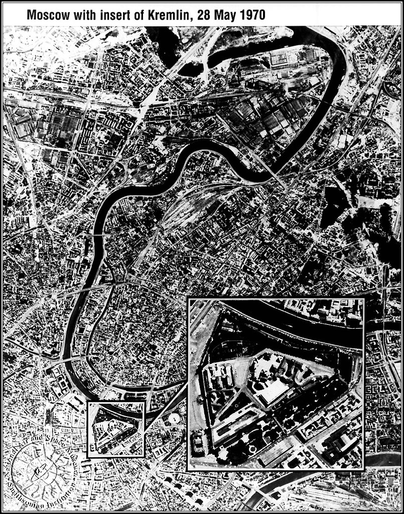
This
photograph, showing Moscow and the Kremlin (insert), was taken by
a Corona satellite in 1970. It is possible to distinguish cars from
trucks, as well as a line of people waiting to enter Lenin's Tomb
in Red Square. |
|
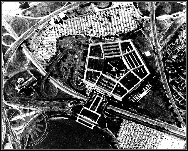
| This
Corona image of the Pentagon, site of U.S. military headquarters,
shows how much detail early spy satellites could reveal. |
|
When
the satellite's main camera snapped a picture of the ground, two small
cameras took a picture of the Earth's horizon at the same time on
the same piece of film.  The horizon cameras helped interpreters calculate
the position of the spacecraft relative to the Earth and verify the
geographical area covered in the photo. This photo with horizon images
at each end is of Luke Air Force Base in Arizona. The horizon cameras helped interpreters calculate
the position of the spacecraft relative to the Earth and verify the
geographical area covered in the photo. This photo with horizon images
at each end is of Luke Air Force Base in Arizona.
Courtesy
of Itek Corporation
|
|
![Moscow with Kremlin, [under magnification]](..\..\SpaceRace\sec400img\431l4p4a.jpg)